
Hiking along the lofty rim of Winter Ridge, I felt as though I was perched high above the desert landscape surrounding southern Oregon’s Summer Lake, 3000 feet below. The view had a dizzying effect on me, much like it did on John Fremont, a western expedition leader who camped with his team on December 16, 1843, at the edge of this escarpment. He wrote, “At our feet–more than a thousand feet below–we looked into a green prairie country, in which a beautiful lake, some twenty miles in length, was spread along the foot of the mountains, its shores bordered with green grass. Just then the sun broke out among the clouds and illuminated the country below; while around us the storm raged fiercely… Shivering on snow three feet deep and stiffening in a cold north wind, we exclaimed at once that the names of Summer Lake and Winter Ridge should be applied to these two proximate places of such sudden and violent contrast.”
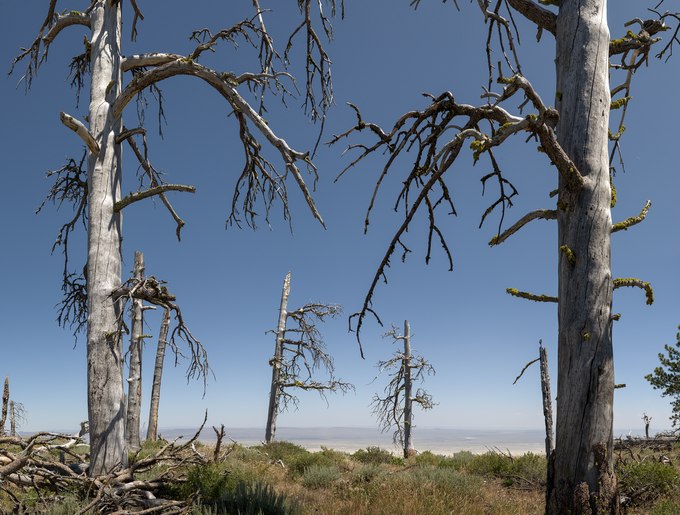
Fremont was correct in every aspect, except for the elevation relief, which is three times greater than he stated. Fremont Point is the highest elevation along the crest of this fault-block mountain. Looking east, it overlooks a deceptive landscape where distant views appear close, and its cliffs and lakes resemble miniatures. Near at hand, today’s rim trail is alonf an infrequently visited and extraordinarily beautiful ridge blanketed with wildflowers, sagebrush, ponderosa pines, aspens, and grassy meadows. The dead trunks and branches in this photograph are remnants of long-lived ponderosas. The cause of their demise is a matter of conjecture, though it is likely the result of a wildfire, bark beetles, drought, old age, or a combination of these factors.