
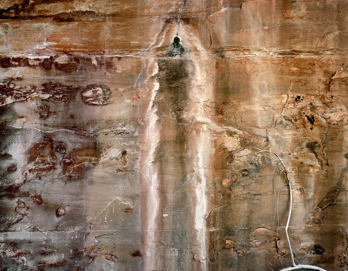
Once upon time, the ancestral Appalachian Mountains eroded into sand and mud, which rivers transported and gradually deposited in an ancient shallow sea that divided the North American continent. The wall in this photograph shows a vertical cross-section of the compressed sediment that, through the aid of moisture and minerals, bonded its grains into a form of concrete called sandstone. Horizontal lines of varying thickness mark the boundaries between these sedimentary layers of cemented sand.
Bleeding from a fracture in the canyon wall, the dripping aquifer stains red sandstone black with mold, then, further down, feeds green and buff-hued lichens. Its source is 800 feet above this wall, where rainwater and snowmelt, dissolving salt embedded in the lithified sand left by that dried-up sea, descends through porous rock layers from the canyon rim to its floor. Once exposed to the desert air by the seep, the saline water crystallizes into a powdery gown of efflorescence.The surface of the wall, covered with lichens, fungi, salt, and desert varnish, creates a poetic abstraction.
Along the bottom of lower Grand Gulch Canyon, before it joins southeastern Utah’s San Juan River, there are other seeps as well as a seasonally active stream channel. Spring runoff and summer flash floods from thunderstorms scrape canyon walls and fill streambed potholes, nourishing plants and wildlife. A fallen limb and its arching branch rest against this wall, a remnant of a cottonwood tree that once bordered this shaded, twisting watercourse.