
Waterfalls are abundant in Oregon, especially in the Columbia River Gorge. They are less common east of the Cascades, where the climate is drier. Central Oregon's Tumalo Creek — whose name comes from the Klamath people's word Tumallowa, meaning "icy water" — is fed by the remnants of a glacier covering the upper slopes of Broken Top. This ancient volcanic cone sits on the crest of the Cascade Mountain Range.
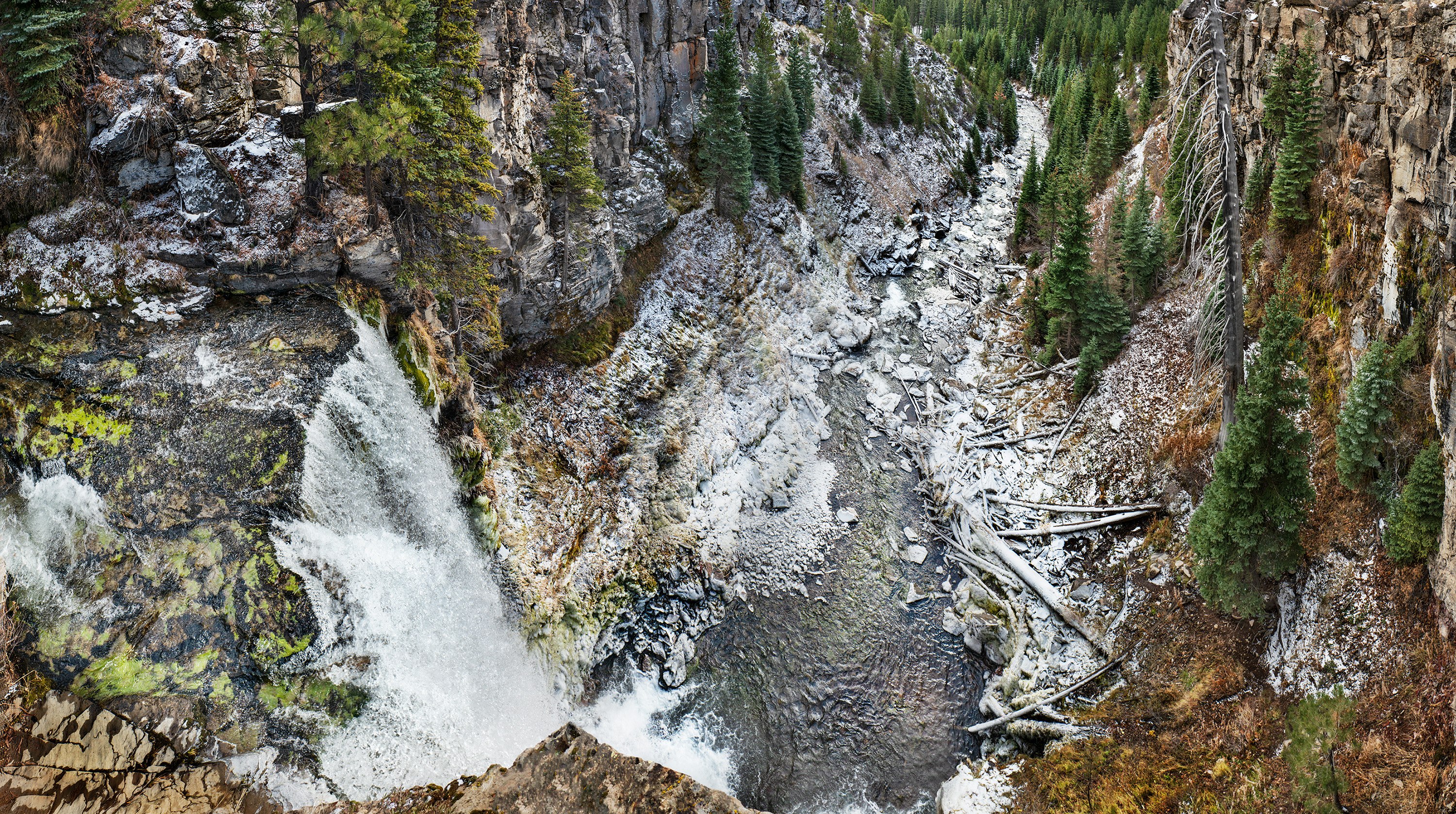
On a cold November morning, I hiked up to the overlook at the top of the falls. The night before, snow had fallen. Later in the morning, the sun broke through, melting the snow on the surrounding plateau and the canyon’s sides. However, the overnight cold settled into the river basin. It preserved a trace of snowfall covering the base of the falls along the stream to the water-diversion dam that provides Bend residents with fresh glacial water.
During the last ice age, glaciers shaped the creek's narrow channel. The 90-foot falls mark the divide between the upper sections of the river that flows down from Broken Top and the flatlands at the mountain's base. The river once flowed higher in cooler, wetter climates. Retreating glaciers and diversions for municipal water to nearby Bend, Oregon, have reduced its flow.
Before the 19th-century settlement of the area, fires frequently swept through, regularly clearing the ponderosa forest. More recently, a large fire in 1979 littered the creek basin with fallen trees, standing snags, and lush new conifer growth.