
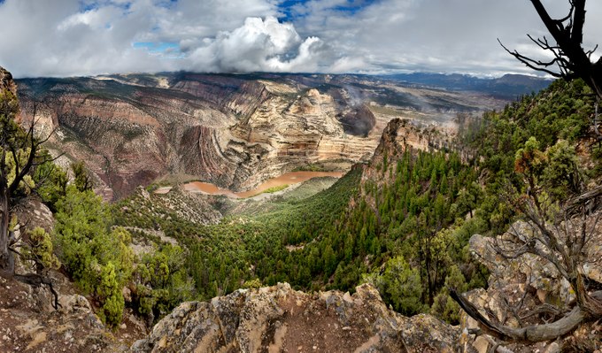
In the waning days of summer a few years ago, I traveled to the heart of Dinosaur National Monument along a road that climbed thousands of feet to an extraordinary overlook. To reach the view in this photograph, I hiked a ridge crest that dropped about one-half mile on both sides, making the trek, if not precarious, thrilling. Here, in the northwestern corner of Colorado, I reached the tip of Harper’s Corner, a narrow promontory above the Green River.
At first, an early-season snowfall clouded the view. As the storm moved east and snowfall subsided, a clearing sky lit the buttes, which together concealed the confluence where the Yampa River entered the Green River. A recent downpour muddied the river after a hot, dry summer. The west-facing ridges were tan from exposed rock and scorched vegetation, while the east-facing slope in the photograph’s shaded foreground retained a vibrant green of Douglas-Fir, Juniper, Ponderosa, and Pinyon Pine.
Below lay the convergence of rivers, mountains, and fault lines. Here, the Yampa merged with the Green River, which was entrenched along an ancient path that carved through what would become the eastern shoulder of the emerging Uinta Mountains encircling it. At the same time, fault lines disrupted and twisted the earth, as best seen in the bowed uplift of previously flat rock layers just to the left of the photograph’s center. Here, geology has remained active, revealing the earth’s continual reshaping.