
Along Nova Scotia’s northwest coast, the steep slopes of Cap-Rouge’s French Mountain meet the southern shore of the Gulf of St. Lawrence. An extension of the Appalachian Mountain chain; Cape Breton’s tablelands are built upon the most ancient known rocks in Canada’s Maritime Provinces.
Skirting its coastline, in 1932 the once rocky Cabot Trail was replaced by a paved scenic highway encircling the cape. Beginning in the early 19th century the “old road” had connected Acadian fishing villages whose families, by 1940, had their homes expropriated with the development of Cape Breton Highlands National Park. This view, from the highway’s ‘look-off’ above ruins of the former settlement, surveys a vast seascape, absent of once numerous inshore fishing dories harvesting cod.
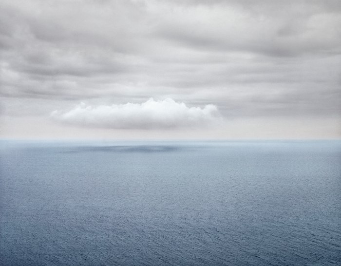
As the outlet for North America’s Great Lakes, the gulf is an estuary of the St. Lawrence River feeding into the Atlantic Ocean. This enclosed sea is less turbulent and, during the summer, milder than the open ocean into which it flows. Every so often, on balmy afternoons, stratocumulus clouds form and drift along the remote coast casting shadows on the sea’s tapestried surface.
- James Baker