
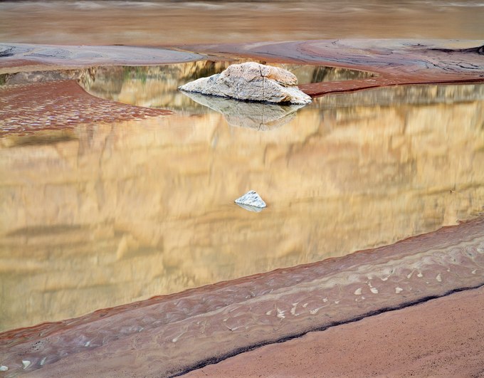
On this quiet morning, the mudflats where John's Canyon meets the San Juan River displayed a fresh layer of sediment as a flood from the previous day abated. A radiant stone and stippled boulder – having long ago tumbled out of the canyon's mouth – rested in an elliptical pool. Its tranquil water luminously mirrored the pre-dawn light reflecting off an 800-foot-tall cliff. The scene struck me as a dreamlike set piece.
Southeastern Utah is almost entirely comprised of sedimentary rock formed from ancestral mountain ranges that eroded into the bottom of an ancient sea and hardened into sandstone. Later, when the Intermountain West uplifted thousands of feet to form the Colorado Plateau, the San Juan River transported enormous amounts of silt and sand as colorful, soft layers of the surrounding mesas wore away.
Moisture streaming from Mexico and the Pacific Ocean feeds monsoonal thunderstorms into the desert southwest from mid-summer to early fall. These storms tend to be short and spotty, with intense, local downpours drenching one canyon and missing others. Floods deposit layers of mud – red, tan, grey, or black – and send them downstream. They originate from an extensive network of side canyons that, on a map, resemble branches of a tree that converge into its trunk, the San Juan River. Examining the clay deposited here, experienced geologists and long-time river guides familiar with these branched canyons can easily identify the flood's origins by its signature colors.
- James Baker