
The Columbia River Gorge marks the boundary between western Washington State and Oregon. A fjord-like 80-mile stretch of river is inhabited by 90 waterfalls. Almost all of them are on the Oregon side, where the topography favors their formation. Over millions of years, hundreds of lava flows built layers of basalt rock that tilted away from the river to form the sheer cliffs, over which the water descended.
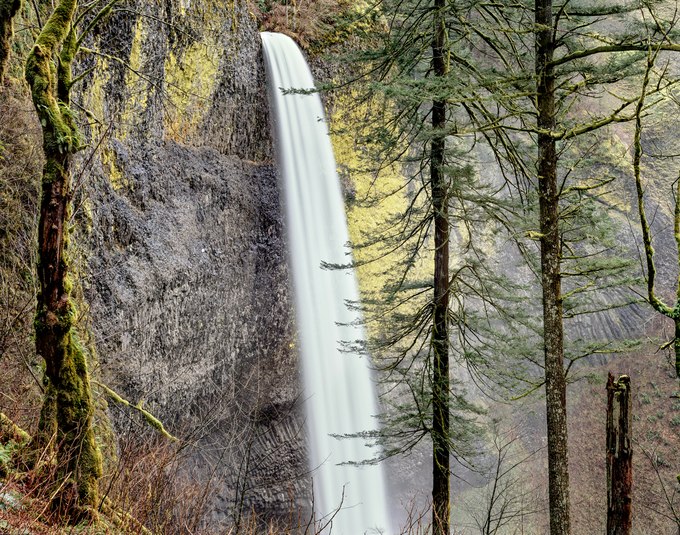
Latourell Falls is the westernmost of the gorge’s major waterfalls, plunging an unbroken 224 feet from the lip of a volcanic bluff to the base of the mist-filled valley of deciduous and conifer trees below. The viscous lava flow that formed this falls, originated nearby. The upper wall behind the falls is rough, where the basalt cooled rapidly. Further down the wall, lava was insulated by the crusty upper part of the flow and cooled more slowly so that the crystalline structure organized itself into symmetrical basalt columns.
In more recent geologic time, following the last ice age, a series of cataclysmic ice and water torrents raged through here – some of the most voluminous in world history – carrying gravels and boulders widening the Columbia River basin that scoured and undercut this basalt cliff. Its rougher upper surface has since become tinted by eye-catching patches of luminous golden-green lichens.
- James Baker